搜索结果: 1-15 共查到“光学 Laser”相关记录152条 . 查询时间(0.151 秒)


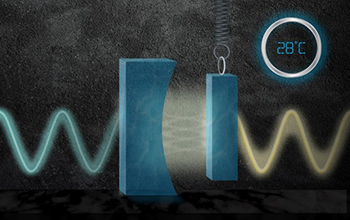
System's ability to boost laser precision at room temperature increases its usability(图)
boost laser precision room temperature increases usability
2020/7/17
Physicists at the Massachusetts Institute of Technology have designed a quantum "light squeezer" that reduces quantum noise in an incoming laser beam by 15%. It is the first system of its ki...

Scientists develop numerical capability of laser-driven X-ray imaging(图)
Scientists numerical capability laser-driven X-ray imaging
2020/7/3
A team of scientists led by University of Nevada Reno physicist Hiroshi Sawada has demonstrated that numerical modeling accurately reproduces X-ray images using laser-produced X-rays.The ima...

Physics of laser frequency combs sheds light on nature’s problem-solving skills(图)
Physics laser frequency combs sheds light problem-solving skills
2019/10/23
Nature has a way of finding optimal solutions to complex problems. For example, despite billions of ways for a single protein to fold, proteins always fold in a way that minimizes potential energy. Sl...
EVALUATING THE STRUCTURAL INTEGRITY OF THE SAINT ANTONIO BARREL VAULT IN THE FORTRESS OF ALMEIDA BY COMBINING LASER SCANNER AND LIMIT ANALYSIS
Historical construction Trace Italienne fortress Masonry Laser scanner Structural diagnosis Limit Analysis
2019/3/4
Under the framework of the modern theory of restoration, this paper shows the experimental results obtained during the structural diagnosis of one of the most important master gates inside the militar...
RESEARCH ON VISUALIZATION OF GROUND LASER RADAR DATA BASED ON OSG
LiDAR Data Visualization OSG Point Cloud Triangulation Network Qt
2018/5/14
Three-dimensional (3D) laser scanning is a new advanced technology integrating light, machine, electricity, and computer technologies. It can conduct 3D scanning to the whole shape and form of space o...
AUTOMATIC EXTRACTION OF ROAD MARKINGS FROM MOBILE LASER-POINT CLOUD USING INTENSITY DATA
Laser Scanning Road Marking Point Cloud High Precision Map Adaptive Threshold Segmentation
2018/5/16
With the development of intelligent transportation, road’s high precision information data has been widely applied in many fields. This paper proposes a concise and practical way to extract road marki...
MASSIVE LINKING OF PS-INSAR DEFORMATIONS TO A NATIONAL AIRBORNE LASER POINT CLOUD
Airborne Laser Scanning PS-InSAR geolocation deformation monitoring local surface reconstruction data fusion
2018/6/5
Build on soft soil, close to sea level the Netherlands is at high risk for the effects of subsidence and deformation. Interferometric Synthetic Aperture Radar (InSAR) is successfully used to monitor t...

深圳大学光电工程学院张晗教授和文侨副教授在Laser&PhotonicsReviews发表正封面论文(图)
深圳大学光电工程学院 张晗教授 文侨副教授 Laser&PhotonicsReviews 非线性光学
2018/3/14
近日,光学一区期刊Laser& Photonics Reviews期刊刊登了题为“Broadband Nonlinear Photonics in Few-Layer MXene Ti3C2Tx (T = F, O, or OH)”的正封面论文。蒋先涛博士后和刘顺祥硕士为共同第一作者,光电工程学院的张晗教授和文侨副教授为该论文的共同通信作者。MXene作为一种新型的二维材料家族,由于其强的导电性、...
On behalf of the Conference Chairs and the International Program Committee, we invite you to participate by submitting your abstract to the Pacific-Rim Laser Damage Symposium: Optical Materials for Hi...
第三届国际高功率激光科学与工程研讨会(The 3rd International symposium on High Power Laser Science and Engineering)
第三届 国际高功率激光科学与工程 研讨会
2017/10/26
International symposium series on High Power Laser Science and Engineering(HPLSE) is held every two years, aiming at bringing together world-wide scientists
and engineers working on high power laser ...
The 3rd International symposium on High Power Laser Science and Engineering(HPLSE2018)
The 3rd International symposium High Power Laser Science and Engineering
2017/9/22
International symposium series on High Power Laser Science and Engineering(HPLSE) is held every two years, aiming at bringing together world-wide scientists and engineers working on high power laser a...
CHARACTERISATION OF INTENSITY VALUES ON TERRESTRIAL LASER SCANNING FOR RECORDING ENHANCEMENT
Terrestrial Laser Scanning (TLS) Calibration Colour CIE colour spaces Documentation Archaeology Rock Art
2017/8/30
Mapping surveys based on terrestrial laser scanning (TLS) are common nowadays for different purposes such as documentation of cultural heritage assets. The chance to extract relevant information from ...


