搜索结果: 1-15 共查到“Augmented Reality”相关记录24条 . 查询时间(0.169 秒)


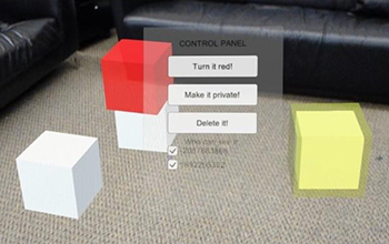
New tools minimize risks in shared,augmented-reality environments(图)
New tool minimize risks augmented-reality environments
2019/10/21
A few summers ago, throngs of people began using the Pokemon Go app, the first mass-market augmented reality (AR) game, to collect virtual creatures hiding in the physical world.For now, AR remains mo...
COMBINING INDEPENDENT VISUALIZATION AND TRACKING SYSTEMS FOR AUGMENTED REALITY
augmented reality pose estimation tracking calibration visualization
2018/6/4
The basic requirement for the successful deployment of a mobile augmented reality application is a reliable tracking system with high accuracy. Recently, a helmet-based inside-out tracking system whic...
3D SURVEY AND AUGMENTED REALITY FOR CULTURAL HERITAGE. THE CASE STUDY OF AURELIAN WALL AT CASTRA PRAETORIA IN ROME
Close-range photogrammetry Documentation of Cultural Heritage Virtual Reconstruction Augmented Reality
2016/11/11
The development of close-range photogrammetry has produced a lot of new possibility to study cultural heritage. 3D data acquired with conventional and low cost cameras can be used to document, investi...
APPROACH AND EVALUATION OF A MOBILE VIDEO-BASED AND LOCATION-BASED AUGMENTED REALITY PLATFORM FOR INFORMATION BROKERAGE
Augmented Reality Image tracking Edutainment ARML GPS Beacons Gamification User Experience
2016/10/14
Providing mobile location-based information for pedestrians faces many challenges. On one hand the accuracy of localisation indoors and outdoors is restricted due to technical limitations of GPS and B...
SENSORS FOR LOCATION-BASED AUGMENTED REALITY THE EXAMPLE OF GALILEO AND EGNOS
Augmented Reality Sensors Galileo Photogrammetry
2016/7/5
Augmented Reality has long been approached from the point of view of Computer Vision and Image Analysis only. However, much more sensors can be used, in particular for location-based Augmented Reality...
LBS AUGMENTED REALITY ASSISTIVE SYSTEM FOR UTILITIES INFRASTRUCTURE MANAGEMENT THROUGH GALILEO AND EGNOS
LBS 3D GIS augmented reality utilities Galileo photogrammetry pose estimation
2016/7/5
There is a continuous and increasing demand for solutions, both software and hardware-based, that are able to productively handle underground utilities geospatial data. Innovative approaches that are ...
New tool for virtual and augmented reality uses ‘deep learning’
New tool virtual augmented deep learning
2016/7/4
Future systems that allow people to interact with virtual environments will require computers to interpret the human hand’s nearly endless variety and complexity of changing motions and joint angles.I...
Application of Augmented Reality GIS in Architecture
Augmented Reality 3D GIS Architecture
2015/12/16
Paper discusses the function and meaning of ARGIS in architecture through an instance of an aerodrome construction project. In the
initial stages of the construction, it applies the advanced technolo...
Merging Augmented Reality Based Features in Mobile Multimedia Museum Guides
Augmented Reality Cultural Heritage Mobile Museum Guides Assisted Learning Education Entertainment
2015/11/13
Augmented Reality (AR), a computer science field considered by many as a subfield of the broader concept of Mixed Reality, could alter dramatically the way we interact not only with computers but also...
AN AUGMENTED REALITY SYSTEM FOR EARTHQUAKE DISASTER RESPONSE
Disaster Earthquakes Decision Support
2015/6/1
The paper describes the augmented reality system (ARS) developed as part of a disaster management tool of the Collaborative
Research Centre 461 (CRC461) at the Universität Karlsruhe (TH). An AR...
ASSESSING THE POTENTIAL UTILITY OF A VIRTUAL AND MIXED/AUGMENTED REALITY SYSTEM TO ASSIST IN STROKE REHABILITATION
VIRTUAL MIXED
2015/5/27
Stroke is the number one cause of disability in the United States. This thesis summarizes current techniques and technologies for stroke rehabilitation and in addition, describes a revolutionary new c...
WAY-FINDING ASSISTANCE SYSTEM FOR UNDERGROUND FACILITIES USING AUGMENTED REALITY
Augmented Reality Structure from Motion Way-finding Navigation Assistance Underground Facilities
2015/5/21
Way-finding is one of main challenges for pedestrians in large subterranean spaces with complex network of connected labyrinths. This problem is caused by the loss of their sense of directions and ori...
APPLICATIONS OF PANORAMIC IMAGES: FROM 720° PANORAMA TO INTERIOR 3D MODELS OF AUGMENTED REALITY
Panoramic Images Close-range Photogrammetry 3D Point Cloud 3D Indoor Modeling
2015/5/21
A series of panoramic images are usually used to generate a 720° panorama image. Although panoramic images are typically used for establishing tour guiding systems, in this research, we demonstrate th...
APPLICATION OF AN AUGMENTED REALITY SYSTEM FOR DISASTER RELIEF
Augmented Reality Calibration Algorithms
2015/5/19
The goal of an augmented reality system (ARS) is to superimpose in real time a real world scenery with a virtual extended version of itself. Such an ARS is, also developed as part of a disaster manage...


