搜索结果: 1-15 共查到“soil surface”相关记录22条 . 查询时间(0.126 秒)

Early detection of soil-surface ozone helps prevent damage to grapevines and apple trees(图)
Early detection soil-surface ozone prevent damage grapevines apple trees
2020/9/18
The resilient polymer tattoos placed on the leaves allow for "frequent and long-term monitoring of cellular ozone damage in economically important crops such as grapes and apples," Andrew says."We sel...

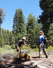
Study explores how rock expands near soil surface in Sierra Nevada(图)
rock expands soil surface Sierra Nevada
2019/10/18
A University of Wyoming researcher and his team have discovered that weathering of subsurface rock in the southern Sierra Nevada Mountains of California is due more to rocks expanding than to chemical...
USING MULTI-DIMENSIONAL MICROWAVE REMOTE SENSING INFORMATION FOR THE RETRIEVAL OF SOIL SURFACE ROUGHNESS
Radar SAR PolSAR Soil Surface Roughness airborne in-field measurements
2016/12/1
In this Paper the potential of multi parametric polarimetric SAR (PolSAR) data for soil surface roughness estimation is investigated and its potential for hydrological modeling is evaluated. The study...
Soil surface CO2 fluxes in a Norway spruce stand
Norway spruce Picea abies soil CO2 efflux Q10
2015/2/2
The measurements of soil CO2 efflux in a Norway spruce (Picea abies [L.] Karst.) forest stand are reported for a 6-month period (from May 1st to October 26th 1999). Forest floor CO2 efflux was measure...
Comparison of Instrumentation to Measure Air and Soil-Surface Temperature Variability in Northern Alaska
Measure Air Soil-Surface Temperature Variability
2015/1/7
The Circumpolar Active Layer Monitoring (CALM) project has been observing permafrost (perennially frozen ground) and its overlaying active layer (which freezes and thaws annually) in northern Alas...
Using model reduction to predict the soil-surface C18OO flux: an example of representing complex biogeochemical dynamics in a computationally efficient manner
Using model reduction predict the soil-surface C18OO flux representing complex biogeochemical dynamics computationally efficient manner
2014/12/16
Earth system models (ESMs) must calculate large-scale interactions between the land and atmosphere while accurately characterizing fine-scale spatial heterogeneity in water, carbon, and other nutrient...
南京农业大学土壤学课件 Soil colloidal chemistry and soil surface reaction
南京农业大学 土壤学 课件 Soil colloidal chemistry and soil surface reaction
2014/7/14
南京农业大学土壤学课件 Soil colloidal chemistry and soil surface reaction。
An inversion method based on multi-angular approaches for estimating bare soil surface parameters from RADARSAT-1
multi-angular approaches estimating bare soil surface parameters
2010/12/22
This paper focuses on inversion of these parameters using a multi-angular approach based on RADARSAT-1 data with incidence angles of 35° and 47° (in mode S3 and S7). This inversion was performed with ...
基于激光反射的土壤表面粗糙度测量装置设计与试验(Design of a Laser Scanner for Characterizing Soil Surface Roughness)
土壤 粗糙度 三角测距法 激光测距传感器
2010/1/28
为了实时获取土壤表面粗糙度数据,设计了一种基于激光三角测距原理的土壤表面粗糙度专用测量装置。采用激光扫描测距仪测量微位移,其精度高、响应速度快,测距分辨力高达0.1mm,显著提高了土壤表面粗糙度的测量精度;借助于光电编码盘和螺杆组合实现高精度扫描定位;PDA作为上位机,农田环境下具有方便携带,大容量存储数据和智能化实时处理功能等优点。
A New Instrument for Testing Wind Erosion by Soil Surface Shape Change
Wind Erosion Soil Surface Shape Change
2009/12/2
Wind erosion, a primary cause of soil degeneration, is a problem in arid and semiarid areas throughout the world. Many methods are available to study soil erosion, but there is no an effective method ...
Describing soil surface microrelief by crossover length and fractal dimension
soil surface microrelief rossover length fractal dimension
2009/11/3
Accurate description of soil surface topography is essential because different tillage tools produce different soil surface roughness conditions, which in turn affects many processes across the soil s...
Quantification of tillage,plant cover,and cumulative rainfall effects on soil surface microrelief by statistical,geostatistical and fractal indices
tillage plant cover cumulative rainfall effects soil surface microrelief
2009/11/2
Changes in soil surface microrelief with cumulative rainfall under different tillage systems and crop cover conditions were investigated in southern Brazil. Surface cover was none (fallow) or the crop...
Assessing soil surface roughness decay during simulated rainfall by multifractal analysis
soil surface roughness decay simulated rainfall multifractal analysis
2009/11/2
Understanding and describing the spatial characteristics of soil surface microrelief are required for modelling overland flow and erosion. We employed the multifractal approach to characterize topogra...
农田土壤表层粗糙度信息解析(Soil Surface Roughness Indices,Interpretation and Application)
土壤 粗糙度 耕作 时空变异 信息解析
2010/4/1
耕作后农田土壤地貌属于具有趋向性的随机表面。由随机过程角度看,它随时间的变异满足各态遍历性质。揭示它的时空变异特征对于客观评价农田耕作质量、探讨表层土壤水运移规律、优化农田管理具有较高的实用价值。因此,基于各种粗糙指数的信息解析是精细农业技术体系研究热点之一。本文从不同尺度数学模型、时空变异多因素分析、直接与潜在应用价值等方面作了系统性分析。 The surface elevation of a ...
Seedling Establishment of Rice Sown on Soil Surface in Flooded Paddy Field : I. Varietal difference in seedling establishment
Direct seeding Establishment Floating seedling Flooded paddy field Rice Seedling establishment
2009/7/23
Field experiments were carried out to clarify the differences and key factors in the rate of seedling establishment among rice varieties sown on the soil surface in flooded paddy fields. The percentag...

