搜索结果: 1-15 共查到“理学 Automated”相关记录47条 . 查询时间(0.033 秒)

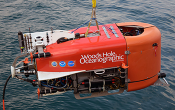
Underwater robot takes first known automated sample from ocean(图)
Underwater robot takes automated sample ocean
2020/1/19
A hybrid remotely operated vehicle developed by NSF-funded Woods Hole Oceanographic Institution researchers took the first known automated ocean sample performed by a robotic arm. Last ...
SEMI AUTOMATED LAND COVER LAYER UPDATING PROCESS UTILIZING SPECTRAL ANALYSIS AND GIS DATA FUSION
NTDB (National Topographic Data Base), Segmentation, Classification, nDSM, data fusion
2018/5/11
Technological improvements made in recent years of mass data gathering and analyzing, influenced the traditional methods of updating and forming of the national topographic database. It has brought a ...
AUTOMATED MOSAICKING OF GEOSTATIONARY OCEAN COLOR IMAGER BY COMBINATION OF SPATIAL AND FREQUENCY MATCHING
GOCI Ocean Image Mosaicking Geometric Correction Frequency Matching
2018/6/4
In general, image mosaicking is a useful and important processing for handling images with narrow field of view. It is being used widely for images from commercial cameras as well as from aerial and s...
SEMI-AUTOMATED APPROACH FOR MAPPING URBAN TREES FROM INTEGRATED AERIAL LiDAR POINT CLOUD AND DIGITAL IMAGERY DATASETS
Extraction Integrated Airborne LiDAR Multispectral Image Urban Trees
2016/10/14
Mapping of trees plays an important role in modern urban spatial data management, as many benefits and applications inherit from this detailed up-to-date data sources. Timely and accurate acquisition ...
Automated DEM extraction in digital aerial photogrammetry: precisions and validation for mass movement monitoring
digital photogrammetry automatic processing DEM precision monitoring
2015/9/10
Automated procedures for photogrammetric image processing and Digital Elevation Models (DEM) extraction
yield high precision terrain models in a short time, reducing manual editing; their accuracy is...
Dissolved CO2 in natural waters: development of an automated monitoring system and first application to Stromboli volcano (Italy)
Gas–water interaction Dissolved CO2 Fluid geochemistry Geochemical monitoring
2015/8/27
The study of geochemical parameters applied to natural systems has provided improved knowledge of geochemical mechanisms of gas/rock dissolution in natural waters that are linked to gas–water and/or w...
Automated control procedures and first results from the temporary seismic monitoring of the 2012 Emilia sequence
Data quality control Emilia sequence 2012 Automatic earthquake location 3D tomographic model
2015/8/26
After moderate to strong earthquakes in Italy or in the surrounding areas, the Istituto Nazionale di Geofisica e Vulcanologia (INGV; National Institute for Geophysics and Volcanology) activates a temp...
Automated extraction of pair wise structure lines using airborne laserscanner data in coastal areas
Laser scanning LIDAR structure and breakline detection surface
2015/8/13
The coastline of the North Sea is characterized by a large number of different morphological objects like dikes, dunes and tidal
creeks. Due to the tidal effects and other natural forces the shape, s...
System for Automated Geoscientific Analyses (SAGA) v.2.1.4
Automated Geoscientific Analyses
2015/8/6
The System for Automated Geoscientific Analyses (SAGA) is an open source geographic information system (GIS), mainly licensed under the GNU General Public License. Since its first release in 2004, SAG...
RAPID: Research on Automated Plankton Identification
Automated Plankton Identification Plankton
2015/7/22
When Victor Hensen deployed the first true plankton net in 1887, he and his colleagues were attempting to answer three fundamental questions: What planktonic organisms are present in the ocean? How ma...
A Combined Automated Generalization Model of Spatial Active Objects
Generalization Cartography GIS Automation
2015/7/6
Automating the map generalization process has traditionally been a major focus of research in cartography and
GIS environment. Many algorithms and models have been developed over the past three decad...
Automated tracking of shallow cumulus clouds in large domain, long duration large eddy simulations
shallow cumulus clouds large domain
2014/12/12
This paper presents a method for feature tracking of fields of shallow cumulus convection in large eddy simulations (LES) by connecting the projected cloud cover in
space and time, and by accou...
Automated continuous verification for numerical simulation
Discrete Coding Mathematical model software
2014/12/9
Verification is a process crucially important for the final users of a computational model: code is useless if its results cannot be relied upon. Typically, verification is seen as a discrete event, p...
iGen 0.1: a program for the automated generation of models and parameterisations
automated generation models parameterisations
2014/12/9
Complex physical systems can often be simulated using very high resolution models but this is not always practical because of computational restrictions. In this case the model must be simplified or p...
iGen 0.1: the automated generation of a parameterisation of entrainment in marine stratocumulus
automated generation parameterisation entrainment in marine stratocumulus
2014/12/9
In a previous paper we described a new technique for automatically generating parameterisations using a program called iGen. iGen generates parameterisations by analysing the source code of a~high res...

