搜索结果: 1-15 共查到“理学 Images”相关记录133条 . 查询时间(0.213 秒)

New black hole images reveal a glowing, fluffy ring and a high-speed jet(图)
黑洞图像 高速喷气机 等离子体物理学
2023/6/9
Academy of Mathematics and Systems Science, CAS Colloquia & Seminars:Notes on black hole images
黑洞 图像 注意事项
2023/4/13


Robotic underwater vehicle snaps first images of seafloor beneath Antarctica's Thwaites Glacier(图)
Robotic underwater vehicle snaps first images seafloor beneath Antarctica Thwaites Glacier
2020/2/20
During the first study of the ocean floor beneath Antarctica’s Thwaites Glacier, scientists took images of the glacier's foundations. Thwaites now accounts for about 4% of global sea level rise, and r...

NSF’s newest solar telescope produces first images(图)
NSF newest solar telescope first images
2020/2/20
ust released first images from the National Science Foundation’s Daniel K. Inouye Solar Telescope reveal unprecedented detail of the sun’s surface and preview the world-class products to come from thi...

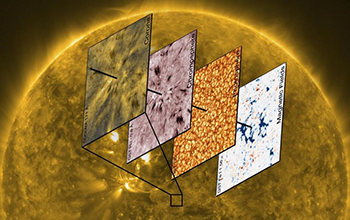
Images from solar observatory peel away layers of a stellar mystery(图)
Images solar observatory peel away layers stellar mystery
2019/11/22
NSF-funded scientists at the New Jersey Institute of Technology have shed new light on one of the central mysteries of solar physics: how energy from the sun is transferred to the star's upper atmosph...
中国地质大学科学技术发展院夏宇轩(博士研究生), 蔡建超*等, 地空学院 Journal of Hydrology, 2019, Fractal dimension, lacunarity and succolarity analyses on CT images of reservoir rocks for permeability prediction
储层岩石;复杂;微观结构;定量;表征;渗透率;建模领域
2021/10/20
近日,中国地质大学地空学院蔡建超教授团队在国际著名地学期刊Journal of Hydrology上发表了储层岩石复杂微观结构定量表征及渗透率建模领域的研究成果:“Fractal dimension, lacunarity and succolarity analyses on CT images of reservoir rocks for permeability prediction”。该文...
SPECTRAL-SPATIAL CLASSIFICATION OF HYPERSPECTRAL REMOTE SENSING IMAGES USING VARIATIONAL AUTOENCODER AND CONVOLUTION NEURAL NETWORK
Hyperspectral classification feature extraction spectral channels deep learning
2019/2/28
In this paper, we propose a spectral-spatial feature extraction framework based on deep learning (DL) for hyperspectral image (HSI) classification. In this framework, the variational autoencoder (VAE)...
A MULTI THREADED FEATURE EXTRACTION TOOL FOR SAR IMAGES USING OPEN SOURCE SOFTWARE LIBRARIES
software architecture feature extraction SAR images remote sensing applications algorithms of high complexity multi-threaded platform
2019/2/27
In this paper, we propose a software architecture for a feature extraction tool which is suitable for automatic extraction of sparse features from large remote sensing data capable of using higher ord...
SYNOPTIC OBSERVATIONS OF CALVING EVENTS IN ANTARCTICA USING SPACEBORNE IMAGES
Antarctica Calving Optical Images Rifts Icebergs
2019/2/28
Iceberg calving is the detachment of ice from ice shelves or glaciers. Although calving is a natural phenomenon, an abnormal rate of calving can be a threat to ice shelves. Some of the events were so ...
MULTISPECTRAL AND PANCHROMATIC REGISTRATION OF ALSAT-2 IMAGES USING DENSE VECTOR MATCHING FOR PAN-SHARPENING PROCESS
Pan-sharpening band to band registration image-based registration Dense Vector Matching Alsat-2
2018/6/4
The pan-sharpening is a widely used operation in remote sensing image processing, this operation aims at combining an observable high spatial resolution panchromatic image with a multispectral one, to...
THE ONE TO MULTIPLE AUTOMATIC HIGH ACCURACY REGISTRATION OF TERRESTRIAL LIDAR AND OPTICAL IMAGES
Ground Lidar Optical Image Automatic High Precision Registration
2018/5/15
The registration of ground laser point cloud and close-range image is the key content of high-precision 3D reconstruction of cultural relic object. In view of the requirement of high texture resolutio...
SHIP DETECTION BASED ON MULTIPLE FEATURES IN RANDOM FOREST MODEL FOR HYPERSPECTRAL IMAGES
Hyperspectral Image Ship Detection Multiple Feature Spectral Feature Texture Feature Random Forest (RF)
2018/5/14
A novel method for detecting ships which aim to make full use of both the spatial and spectral information from hyperspectral images is proposed. Firstly, the band which is high signal-noise ratio in ...
NEAR REAL-TIME GEOREFERENCE OF UMANNED AERIAL VEHICLE IMAGES FOR POST-EARTHQUAKE RESPONSE
UAV images Georeference Earthquake emergency Disaster information World File
2018/5/15
The rapid collection of Unmanned Aerial Vehicle (UAV) remote sensing images plays an important role in the fast submitting disaster information and the monitored serious damaged objects after the eart...
ROAD DAMAGE EXTRACTION FROM POST-EARTHQUAKE UAV IMAGES ASSISTED BY VECTOR DATA
Road damage extraction Damage assessment Earthquake UAV images Object-oriented classification Threshold detection
2018/5/11
Extraction of road damage information after earthquake has been regarded as urgent mission. To collect information about stricken areas, Unmanned Aerial Vehicle can be used to obtain images rapidly. T...


