搜索结果: 1-3 共查到“理学 drone”相关记录3条 . 查询时间(0.062 秒)

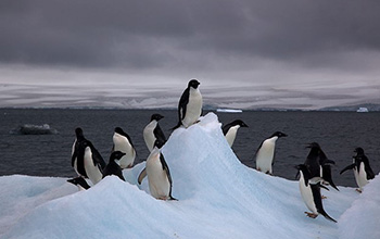
Autonomous multi-drone aerial surveys of Antarctic penguin colonies(图)
Autonomous multi-drone aerial surveys Antarctic penguin colonies
2020/11/13
Scientist Mac Schwager at Stanford University, an aeronautics and astronautics researcher, learned that biologists were seeking a better way to image a large penguin colony in Antarctica. Schwage...
OPTIMIZING RADIOMETRIC PROCESSING AND FEATURE EXTRACTION OF DRONE BASED HYPERSPECTRAL FRAME FORMAT IMAGERY FOR ESTIMATION OF YIELD QUANTITY AND QUALITY OF A GRASS SWARD
Hyperspectral Photogrammetry Calibration Feature Estimation
2018/5/15
Light-weight 2D format hyperspectral imagers operable from unmanned aerial vehicles (UAV) have become common in various remote sensing tasks in recent years. Using these technologies, the area of inte...
REAL-TIME AND POST-PROCESSED GEOREFERENCING FOR HYPERPSPECTRAL DRONE REMOTE SENSING
Photogrammetry Real-time georeferencing drone Hyperspectral frame camera Remote Sensing
2018/6/4
The use of drones and photogrammetric technologies are increasing rapidly in different applications. Currently, drone processing workflow is in most cases based on sequential image acquisition and pos...

