搜索结果: 1-15 共查到“自然地理学 in China”相关记录29条 . 查询时间(0.156 秒)
Spatial and seasonal variation of water parameters, sediment properties, and submerged macrophytes after ecological restoration in a long-term (6 year) study in Hangzhou west lake in China
Hangzhou west lake macrophytes ecological restoration
2021/7/28
Submerged macrophyte restoration is the key stage in the reestablishment of an aquatic ecosystem.
Natural traps of spores and pollen grains from the region surrounding Wenbi Reservoir, Yunnan, China
natural pollen traps Wenbi Reservoir Yunnan China vegetation
2014/1/16
We did a comparative analysis of pollen and spores from five kinds of natural pollen traps at Wenbi Reservoir, northwest Yunnan, China. The natural traps were the surface soil, ground inhabiting mosse...

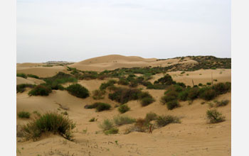
Ancient China's Sand Dunes Reveal Unexpected Dryness During Heavy Monsoon Rains(图)
Ancient China's Sand Dunes Unexpected Dryness Heavy Monsoon Rains
2009/10/10
The windswept deserts of northern China might seem an odd destination for studying the heavy monsoon rains that routinely drench the more tropical regions of Southeast Asia. But the sandy dunefields t...
Understanding cultivated land dynamics and its driving forces in northern China during 1983-2001
2007/8/24
Based on the long-term serial NOAA/NDVI dataset during 1983-1999 and SPOT/VGT dataset in 2001, the land use/cover change information in the 13 provinces of northern China was extracted bas...
Danxia geomorphology originates from China. This paper studies the spatial distribution and differences in characteristics of Danxia landforms. Based on relevant research and investigation...
The Boao coastal system along the eastern coast of Hainan Island is a dynamic delta-tidal inlet-barrier formed during the late Holocene. The delta developed inside a shallow lagoon barred ...
Modelling scenarios of land use change and their impacts in typical regions are helpful to investigate the mechanism between land use and ecological systems and process the land use alloca...
A comparison between different ecological de-farming modes in the loess hilly-gully region in China
2007/8/24
The eco-environmental restoration has been a chief task of the western development strategies carried out by the central and local governments of China since the late 1990s, and the ecolog...
Qinghai-Tibet Plateau (1.65). The anisotropic analysis indicates that the variation of fragmentation index in east-west direction is larger than that in south-north direction. Paper(PDF...
Sandy desertification is land degradation characterized by wind erosion mainly resulted from the excessive human activities in arid, semiarid and part of sub-humid regions in northern Chin...
Coastline configuration and geomorphologic development mode of arc-shaped coast in South China
2007/8/24
Coastline configuration indexes of 34 typical arc-shaped coasts in South China are investigated by the method of principal component analysis, and meanwhile deposition and geomorphologic f...
During the last decade of the 20th century, extensive conversion in agricultural land use took place in Northeast China. The goal of this study is to ascertain its spatial distribution and...
China possesses over 110 international rivers and lakes, among which 41 are major ones and 15 are of great importance. With the highest concentration of international rivers, the northeast...
Traditional wetland study in China mainly focuses on mire resources investigation and utilization. At present, environment, resources problems and sustainable development theory have infus...
The lake science development in China
2007/8/24
China is a country abundant in lakes. Lake science development in China, not only aims at the international frontiers of correlative subject development, but also focuses on the national s...

